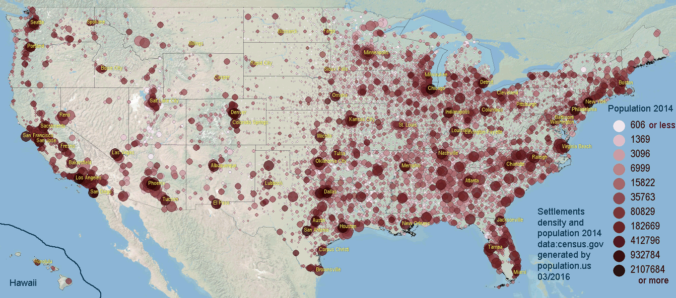
Population statistics and maps (population, density and changes) for approximately 20 000 settlements in the US. For cities Most populated cities are...
For settlements we don't have boundary info (only for top 200 most popular cities), but we have official [2] area and location information. Size of the circle is proportional with area of the city; color depend of the population.
Population density is in [p/mi²], changes are for period 2010-2015 in %/year. Click on state name to get more details, historical population and position on map.
A B C D E F G H I J K L M N O P Q R S T U V W X Y Z
Or you can search settlement by state..
Alabama Alaska Arizona Arkansas California Colorado Connecticut Delaware District of Columbia Florida Georgia Hawaii Idaho Illinois Indiana Iowa Kansas Kentucky Louisiana Maine Maryland Massachusetts Michigan Minnesota Mississippi Missouri Montana Nebraska Nevada New Hampshire New Jersey New Mexico New York North Carolina North Dakota Ohio Oklahoma Oregon Pennsylvania Rhode Island South Carolina South Dakota Tennessee Texas Utah Vermont Virginia Washington West Virginia Wisconsin Wyoming
[1] Cities and Towns (Incorporated Places and Minor Civil Divisions) 2014, archived from the original, retrieved 02/23/2016
[2] Area, latitude longitude data, retrieved 02/23/2016
© 2016 population.us | Terms of use | Contact